Please use this identifier to cite or link to this item:
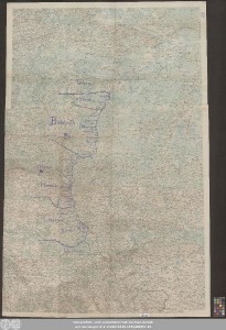
http://dx.doi.org/10.25673/109919| Title: | [Kriegskarte der nordwestlichen Ukraine während des 1. Weltkriegs] |
| Published: | [Deutsche Reich] : [Verlag nicht ermittelbar], [circa 1920] |
| Scale: | 1:200 000 |
| Coordinates: | E 23°49'00"-E 26°49'15"/N 52°29'00"-N 49°30'30" |
| Extent: | 1 Karte; 165 x 108 cm farbig |
| Annotations: | Ohne Kartennetz und Randgraduierung Titel fingiert Mit Bergstrichen Karte |
| Language: | German |
| Online Edition: | Halle (Saale) : Universitäts- und Landesbibliothek Sachsen-Anhalt, 2023 |
| Original Publication: | Universitäts- und Landesbibliothek Sachsen-Anhalt, Altkt C II 2 [5] 12 |
| URN: | urn:nbn:de:gbv:3:3-1192015415-1815385057-15 |
| URI: | https://opendata.uni-halle.de//handle/1981185920/111874 http://dx.doi.org/10.25673/109919 |
| Open Access: |  Open access publication Open access publication |
| License: |  Creative Commons Attribution 4.0") (CC BY 4.0) Creative Commons Attribution 4.0 (CC BY 4.0) Creative Commons Attribution 4.0 |
| Appears in Collections: | Karten und Atlanten |
Ressources:
 |
|