Please use this identifier to cite or link to this item:
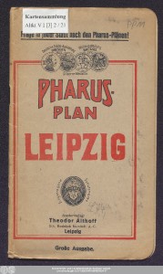
http://dx.doi.org/10.25673/39739| Title: | Pharus-Plan Leipzig / Urheber: Dr. Cornelius Löwe |
| Publisher / Printer: | Pharus-Verlag Heinrich Möller Kaufhaus Althoff |
| Published: | Berlin / Leipzig : Pharus-Verlag G.m.b.H. ; Sonder-Verlag: Theodor Althoff, [1928] |
| Scale: | 1:13 175 |
| Coordinates: | E 12°22'16"/N 51°20'22" |
| Edition: | Große Ausgabe |
| Extent: | 1 Karte; 77 x 104 cm, gefaltet 22 x 13 cm farbig 1 Führer (29 Seiten) |
| Annotations: | Mit Suchnetz Stadtplan |
| Language: | German |
| Online Edition: | Halle (Saale) : Universitäts- und Landesbibliothek Sachsen-Anhalt, 2021 |
| Original Publication: | Universitäts- und Landesbibliothek Sachsen-Anhalt, Altkt V I [3] 2 / 21 |
| URN: | urn:nbn:de:gbv:3:3-1192015415-884515524-17 |
| URI: | https://opendata.uni-halle.de//handle/1981185920/41694 http://dx.doi.org/10.25673/39739 |
| Open Access: |  Open access publication Open access publication |
| License: |  Creative Commons Attribution 4.0") (CC BY 4.0) Creative Commons Attribution 4.0 (CC BY 4.0) Creative Commons Attribution 4.0 |
| Sponsor/Funder: | Die Digitalisierung wurde durch die Deutsche Digitale Bibliothek im Rahmen des von der Beauftragten der Bundesregierung für Kultur und Medien (BKM) geförderten Programms NEUSTART KULTUR ermöglicht. |
| Appears in Collections: | Karten und Atlanten |
Ressources:
 |
|