Bitte benutzen Sie diese Kennung, um auf die Ressource zu verweisen:
http://dx.doi.org/10.25673/39896Langanzeige der Metadaten
| DC Element | Wert | Sprache |
|---|---|---|
| dc.date.accessioned | 2021-12-02T11:34:54Z | - |
| dc.date.available | 2021-12-02T11:34:54Z | - |
| dc.date.issued | 1912 | - |
| dc.identifier.uri | https://opendata.uni-halle.de//handle/1981185920/41851 | - |
| dc.identifier.uri | http://dx.doi.org/10.25673/39896 | - |
| dc.description.sponsorship | Die Digitalisierung wurde durch die Deutsche Digitale Bibliothek im Rahmen des von der Beauftragten der Bundesregierung für Kultur und Medien (BKM) geförderten Programms NEUSTART KULTUR ermöglicht. | - |
| dc.format.extent | 1 Karte; 57 x 69 cm | - |
| dc.format.extent | farbig | - |
| dc.language.iso | ger | - |
| dc.publisher | Justus Perthes | - |
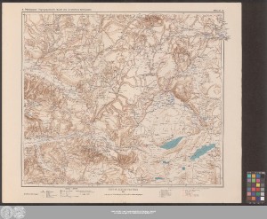
| dc.relation.ispartof | Topographische Karte des westlichen Kleinasien | - |
| dc.rights.uri | https://creativecommons.org/licenses/by/4.0/ | - |
| dc.subject.ddc | 090 | - |
| dc.title | Topographische Karte des westlichen Kleinasien | - |
| dc.type | Map | - |
| dc.identifier.urn | urn:nbn:de:gbv:3:3-1192015415-587852887-17 | - |
| dc.identifier.shelfmark | Altkt L I [4] 2 (4) | - |
| local.openaccess | true | - |
| dc.identifier.ppn | 587852887 | - |
| local.mets.uri | https://opendata.uni-halle.de/retrieve/534aa4ca-713b-4792-bc04-95e6991d77bb/mets.xml | - |
| local.part.order | 4 | - |
| local.part.title | Blatt 4 | - |
| local.holding | Universitäts- und Landesbibliothek Sachsen-Anhalt | - |
| local.holding.displayform | Universitäts- und Landesbibliothek Sachsen-Anhalt, Altkt L I [4] 2 (4) | - |
| dc.contributor.cartographer | Philippson, Alfred | - |
| dc.date.digitization | 2021 | - |
| dc.description.note | Mit Schummerung | - |
| dc.description.note | Randüberzeichnung | - |
| dc.description.note | Karte | - |
| cbs.contenttype.code | cri | - |
| cbs.contenttype.text | kartografisches Bild | - |
| cbs.digitization.displayform | Halle (Saale) : Universitäts- und Landesbibliothek Sachsen-Anhalt, 2021 | - |
| cbs.publication.displayform | Gotha : Justus Perthes, 1912 | - |
| cbs.picatype | Af | - |
| local.map.scale | 1:300 000 | - |
| local.map.scale_sort | 1:300000 | - |
| Enthalten in den Sammlungen: | Karten und Atlanten | |
Ressourcen:
 |
|