Please use this identifier to cite or link to this item:
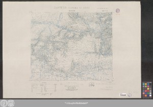
http://dx.doi.org/10.25673/39900| Title: | Mardin |
| Part: | sheet 25 |
| Publisher / Printer: | Frankreich |
| Other: | Großbritannien |
| Published: | [Paris] : Service Géographique de l'Armée, 1940 |
| Scale: | 1:250 000 |
| Coordinates: | E 40°30'-E 42°00'/N 38°00'-N 37°00' |
| Edition: | Tirage de mars 1940; reproduction par la photographie de la Carte de l'État-Major Anglais, I.D.W.O. No. 1522 |
| Extent: | 1 Karte; 45 x 52 cm, auf Blatt 64 x 91 cm farbig |
| Annotations: | Mit Höhenlinien Karte |
| Language: | English French |
| Online Edition: | Halle (Saale) : Universitäts- und Landesbibliothek Sachsen-Anhalt, 2021 |
| Original Publication: | Universitäts- und Landesbibliothek Sachsen-Anhalt, 21 C 138 (25) |
| URN: | urn:nbn:de:gbv:3:3-1192015415-829308865-19 |
| URI: | https://opendata.uni-halle.de//handle/1981185920/41855 http://dx.doi.org/10.25673/39900 |
| Open Access: |  Open access publication Open access publication |
| License: |  Creative Commons Attribution 4.0") (CC BY 4.0) Creative Commons Attribution 4.0 (CC BY 4.0) Creative Commons Attribution 4.0 |
| Sponsor/Funder: | Die Digitalisierung wurde durch die Deutsche Digitale Bibliothek im Rahmen des von der Beauftragten der Bundesregierung für Kultur und Medien (BKM) geförderten Programms NEUSTART KULTUR ermöglicht. |
| Appears in Collections: | Karten und Atlanten |
Ressources:
 |
|