Please use this identifier to cite or link to this item:
http://dx.doi.org/10.25673/39942Full metadata record
| DC Field | Value | Language |
|---|---|---|
| dc.contributor.other | Greve, Wilhelm | - |
| dc.contributor.other | Preußen | - |
| dc.date.accessioned | 2021-12-06T07:00:13Z | - |
| dc.date.available | 2021-12-06T07:00:13Z | - |
| dc.date.issued | 1915 | - |
| dc.identifier.uri | https://opendata.uni-halle.de//handle/1981185920/41897 | - |
| dc.identifier.uri | http://dx.doi.org/10.25673/39942 | - |
| dc.description.sponsorship | Die Digitalisierung wurde durch die Deutsche Digitale Bibliothek im Rahmen des von der Beauftragten der Bundesregierung für Kultur und Medien (BKM) geförderten Programms NEUSTART KULTUR ermöglicht. | - |
| dc.format.extent | 1 Karte; 91 x 67 cm | - |
| dc.format.extent | farbig | - |
| dc.language.iso | fre | - |
| dc.language.iso | ger | - |
| dc.publisher | [Wilhelm Greve] | - |
| dc.rights.uri | https://creativecommons.org/licenses/by/4.0/ | - |
| dc.subject.ddc | 090 | - |
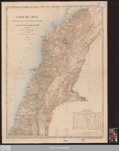
| dc.title | Carte du Liban : d'après les reconnaissances de la Brigade topographique du corps expéditionnaire de Syrie : en 1860-1861 / dressée au Dépôt de la guerre par le Capitaine d'Etat Major Gelis sous le Ministère de S.E. Le Maréchal Comte Randon ; vervielfältigt im Auftrage der Kartogr. Abt. des Stellv. Generalstabes 1915 durch Wilhelm Greve, Kgl. Hoflith., Hofbuch- u. Steindr. Berlin S.W. | - |
| dc.type | Map | - |
| dc.identifier.urn | urn:nbn:de:gbv:3:3-1192015415-1748114050-16 | - |
| dc.identifier.shelfmark | 21 C 29 | - |
| local.openaccess | true | - |
| dc.identifier.ppn | 1748114050 | - |
| local.mets.uri | https://opendata.uni-halle.de/retrieve/a06a5f3a-7c50-4ff1-b138-1bcfe4931dfa/mets.xml | - |
| local.holding | Universitäts- und Landesbibliothek Sachsen-Anhalt | - |
| local.holding.displayform | Universitäts- und Landesbibliothek Sachsen-Anhalt, 21 C 29 | - |
| dc.contributor.cartographer | Gélis, Charles | - |
| dc.contributor.cartographer | Frankreich | - |
| dc.date.digitization | 2021 | - |
| dc.description.note | Maßstab in grafischer Form (echelle métrique, lieues marines) | - |
| dc.description.note | Bergstriche | - |
| dc.description.note | Enthält: "Tableau statistique indiquant la population des Districts du Liban" | - |
| dc.description.note | Karte | - |
| cbs.contenttype.code | cri | - |
| cbs.contenttype.text | kartografisches Bild | - |
| cbs.digitization.displayform | Halle (Saale) : Universitäts- und Landesbibliothek Sachsen-Anhalt, 2021 | - |
| cbs.publication.displayform | [Berlin] : [Wilhelm Greve], 1915 | - |
| cbs.picatype | Aa | - |
| local.map.scale | 1:200 000 | - |
| local.map.scale_sort | 1:200000 | - |
| local.map.coordinates | E 034 43 00-E 036 38 00/N 034 42 00-N 032 50 00 | - |
| local.publication.edition | Revisée en 1913 et 1915 | - |
| Appears in Collections: | Karten und Atlanten | |
Ressources:
 |
|