Please use this identifier to cite or link to this item:
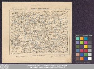
http://dx.doi.org/10.25673/39057| Title: | Provinz Brandenburg |
| Publisher / Printer: | Carl Flemming |
| Published: | In Glogau : Druck u. Verlag von C. Flemming, [circa 1880] |
| Scale: | Circa 1:1 800 000 |
| Coordinates: | E 8°37'-E 14°23'/N 53°42'-N 51°10' |
| Extent: | 1 Karte; 16 x 21 cm Lithografie |
| Annotations: | Maßstab in grafischer Form (Deutsche Meilen, Preussische Meilen) Kopftitel. - Maßstab, Drucker und Verleger unten unter Kartenrahmen Mit Bergstrichen Karte |
| Language: | German |
| Subjects: | Brandenburg |
| Online Edition: | Halle (Saale) : Universitäts- und Landesbibliothek Sachsen-Anhalt, 2021 |
| Original Publication: | Universitäts- und Landesbibliothek Sachsen-Anhalt, Altkt D II 4 [5] 6 |
| URN: | urn:nbn:de:gbv:3:3-1192015415-304008044-18 |
| URI: | https://opendata.uni-halle.de//handle/1981185920/39304 http://dx.doi.org/10.25673/39057 |
| Open Access: |  Open access publication Open access publication |
| License: |  Creative Commons Attribution 4.0") (CC BY 4.0) Creative Commons Attribution 4.0 (CC BY 4.0) Creative Commons Attribution 4.0 |
| Sponsor/Funder: | Die Digitalisierung wurde durch die Deutsche Digitale Bibliothek im Rahmen des von der Beauftragten der Bundesregierung für Kultur und Medien (BKM) geförderten Programms NEUSTART KULTUR ermöglicht. |
| Appears in Collections: | Karten und Atlanten |
Ressources:
 |
|