Please use this identifier to cite or link to this item:
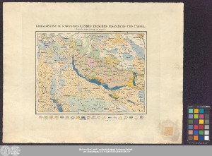
http://dx.doi.org/10.25673/39194| Title: | Geognostische Karte Des Landes Zwischen Magdeburg Und Cassel / Gestochen von Friedr. Wilh. Kliewer |
| Other: | Kliewer, Friedrich Wilhelm |
| Published: | Berlin : bei Simon Schropp et Comp., 1835 |
| Scale: | Circa 1:500 000 |
| Extent: | 1 Karte; 22 x 30 cm Kupferstich |
| Annotations: | Nullmeridian: Ferro Kopftitel Altkarte |
| Language: | German |
| Subjects: | Harz Geologie |
| Online Edition: | Halle (Saale) : Universitäts- und Landesbibliothek Sachsen-Anhalt, 2021 |
| Original Publication: | Universitäts- und Landesbibliothek Sachsen-Anhalt, Altkt D I 5 [2] 6 |
| URN: | urn:nbn:de:gbv:3:3-1192015415-240081390-10 |
| URI: | https://opendata.uni-halle.de//handle/1981185920/41148 http://dx.doi.org/10.25673/39194 |
| Open Access: |  Open access publication Open access publication |
| License: |  Creative Commons Attribution 4.0") (CC BY 4.0) Creative Commons Attribution 4.0 (CC BY 4.0) Creative Commons Attribution 4.0 |
| Sponsor/Funder: | Die Digitalisierung wurde durch die Deutsche Digitale Bibliothek im Rahmen des von der Beauftragten der Bundesregierung für Kultur und Medien (BKM) geförderten Programms NEUSTART KULTUR ermöglicht. |
| Appears in Collections: | Karten und Atlanten |
Ressources:
 |
|