Please use this identifier to cite or link to this item:
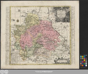
http://dx.doi.org/10.25673/40155| Title: | Delineatio geographica Comitatus Mansfeldensis ad jurisdictionem tum Saxonicam tum Brandenburgicam spectans, cum præfectura Sangerhusana, Querfurtensi, Sittenbacensi, Allstædensi, et locis finitimis / cura Matth: Seutteri, Geogr: Cæs: Aug. Vindel. ; Tob: Conr: Lotter sculps. |
| Other: | Lotter, Tobias Conrad |
| Published: | [Augsburg] : [Matthäus Seutter], [zwischen 1741 und 1757] |
| Scale: | Circa 1:120 000 |
| Extent: | 1 Karte; 48 x 50 cm, auf Blatt 58 x 66 cm Kupferstich |
| Annotations: | Maßstab in grafischer Form (gemeine Teütsche Meile) "Cum Privil: S.M. Polon: et Elect: Saxon." Mit Windrose Titelkartusche oben rechts. - Maßstabskartusche unten rechts. - Erklärungskartusche unten links. - Ortsregister rechts und links auf dem Kartenrand. - Stecher unten rechts auf dem Kartenrand Mit Bergzeichnung Mit Suchnetz Altkarte Erscheinungsjahr zwischen 1741 und 1757, da die Karte das Kaiserliche Privileg führt, welches Seutter 1741 verliehen wurde |
| Note: | Koloriert |
| Language: | Latin |
| Subjects: | Grafschaft Mansfeld Sangerhausen Querfurt Allstedt |
| Online Edition: | Halle (Saale) : Universitäts- und Landesbibliothek Sachsen-Anhalt, 2021 |
| Original Publication: | Universitäts- und Landesbibliothek Sachsen-Anhalt, Altkt D II 7 [2] 16 |
| URN: | urn:nbn:de:gbv:3:3-1192015415-236596373-16 |
| URI: | https://opendata.uni-halle.de//handle/1981185920/42109 http://dx.doi.org/10.25673/40155 |
| Open Access: |  Open access publication Open access publication |
| License: |  Creative Commons Attribution 4.0") (CC BY 4.0) Creative Commons Attribution 4.0 (CC BY 4.0) Creative Commons Attribution 4.0 |
| Sponsor/Funder: | Die Digitalisierung wurde durch die Deutsche Digitale Bibliothek im Rahmen des von der Beauftragten der Bundesregierung für Kultur und Medien (BKM) geförderten Programms NEUSTART KULTUR ermöglicht. |
| Appears in Collections: | Karten und Atlanten |
Ressources:
 |
|