Please use this identifier to cite or link to this item:
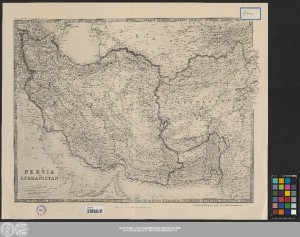
http://dx.doi.org/10.25673/43128| Title: | Persia and Afghanistan / engraved, printed and published by W. & A.K. Johnston limited ; vervielfältigt im Auftrage der Kartogr. Abt. des stellv. Generalstabes |
| Publisher / Printer: | Deutsches Reich |
| Published: | [London] / [Edinburgh] : [W. & A.K. Johnston limited], 1915 |
| Scale: | 1:4 311 000 |
| Coordinates: | E 44°10'00"-E 72°01'00"/N 40°40'00"-N 23°41'00" |
| Extent: | 1 Karte; 43 x 56 cm, auf Blatt 53 x 66 cm, gefaltet 27 x 17 cm 1 Beiheft (24 Seiten) |
| Annotations: | Maßstab in grafischer Form (geographical miles, kilometres, English statute miles) "Keith Johnston's General Atlas" Bergstriche Randüberzeichnung Karte |
| Note: | Ohne Beiheft |
| Language: | English German |
| Online Edition: | Halle (Saale) : Universitäts- und Landesbibliothek Sachsen-Anhalt, 2021 |
| Original Publication: | Universitäts- und Landesbibliothek Sachsen-Anhalt, 21 C 21 |
| URN: | urn:nbn:de:gbv:3:3-1192015415-865955352-15 |
| URI: | https://opendata.uni-halle.de//handle/1981185920/45082 http://dx.doi.org/10.25673/43128 |
| Open Access: |  Open access publication Open access publication |
| License: |  Creative Commons Attribution 4.0") (CC BY 4.0) Creative Commons Attribution 4.0 (CC BY 4.0) Creative Commons Attribution 4.0 |
| Sponsor/Funder: | Die Digitalisierung wurde durch die Deutsche Digitale Bibliothek im Rahmen des von der Beauftragten der Bundesregierung für Kultur und Medien (BKM) geförderten Programms NEUSTART KULTUR ermöglicht. |
| Appears in Collections: | Karten und Atlanten |
Ressources:
 |
|